High resolution layers 2012
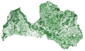
2012: High Resolution Layers - Provides information on specific land cover properties and is suitable for land cover / land use mapping, eg in CLC datasets.
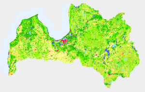
Ground cover in 2012

2012: agricultural land, forests and natural areas, wetlands, water bodies, artificial areas.
Changes in land cover 2006-2012
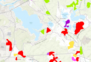
Changes in 2006-2012 year: agricultural land, forests and natural areas, wetlands, water bodies, artificial areas.
Restored ground cover 2006
2006: agricultural land, forests and natural areas, wetlands, water bodies, artificial areas.