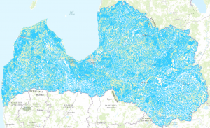
Hydrographic network service

INSPIRE WMS service for hydrography. The service provides an opportunity to prepare data images for the INSPIRE hydrographic network in the territory of Latvia. WMS 1.3.0 standards. The source of the data set is a topographic map at a scale of 1:50 000.
The INSPIRE hydrographic layers were transformed from the same Topographic Map database layers at a scale of 1: 50,000. The database uses an international standard coding system - DFDD (DGIWG Function Data Dictionary). In addition, a military version is being developed that data users can obtain in ESRI vector data formats.