Inspire orthophoto maps
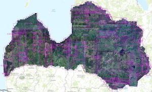
The service includes a color orthophoto map for the entire territory of Latvia, prepared from the 7th cycle orthophoto map. Aerial photography was carried out in the period from 2019 to 2021. Aerial photography was carried out with a resolution of 25 cm, and for the first time for the entire territory of Latvia, the longitudinal coverage between the scenes is 80% (previously - 60%), which ensures the preparation of a high-resolution digital surface model.
Authorized approach with the Creative Commons 4.0 license terms. The service is available free of charge.
WMTS request: Elektronisko pieteikumu sistēmā or email pakalpojumi@lgia.gov.lv